

Reality Capture is becoming faster, more accessible and increasingly integrated, but as acquisition becomes easier, the professional value of surveying may move further towards understanding data and turning it into knowledge.
Reality Capture is evolving rapidly. Terrestrial laser scanning, mobile mapping and mobile laser scanning have traditionally represented different approaches to capturing the physical world, each with its own strengths, applications and professional workflows. Today, however, the boundaries separating these technologies are becoming increasingly blurred. At the same time, faster acquisition, automated processing, artificial intelligence and cloud-connected collaboration raise a broader question for the geomatics community: if capturing reality becomes easier and increasingly accessible, where will the professional value of the surveyor lie?
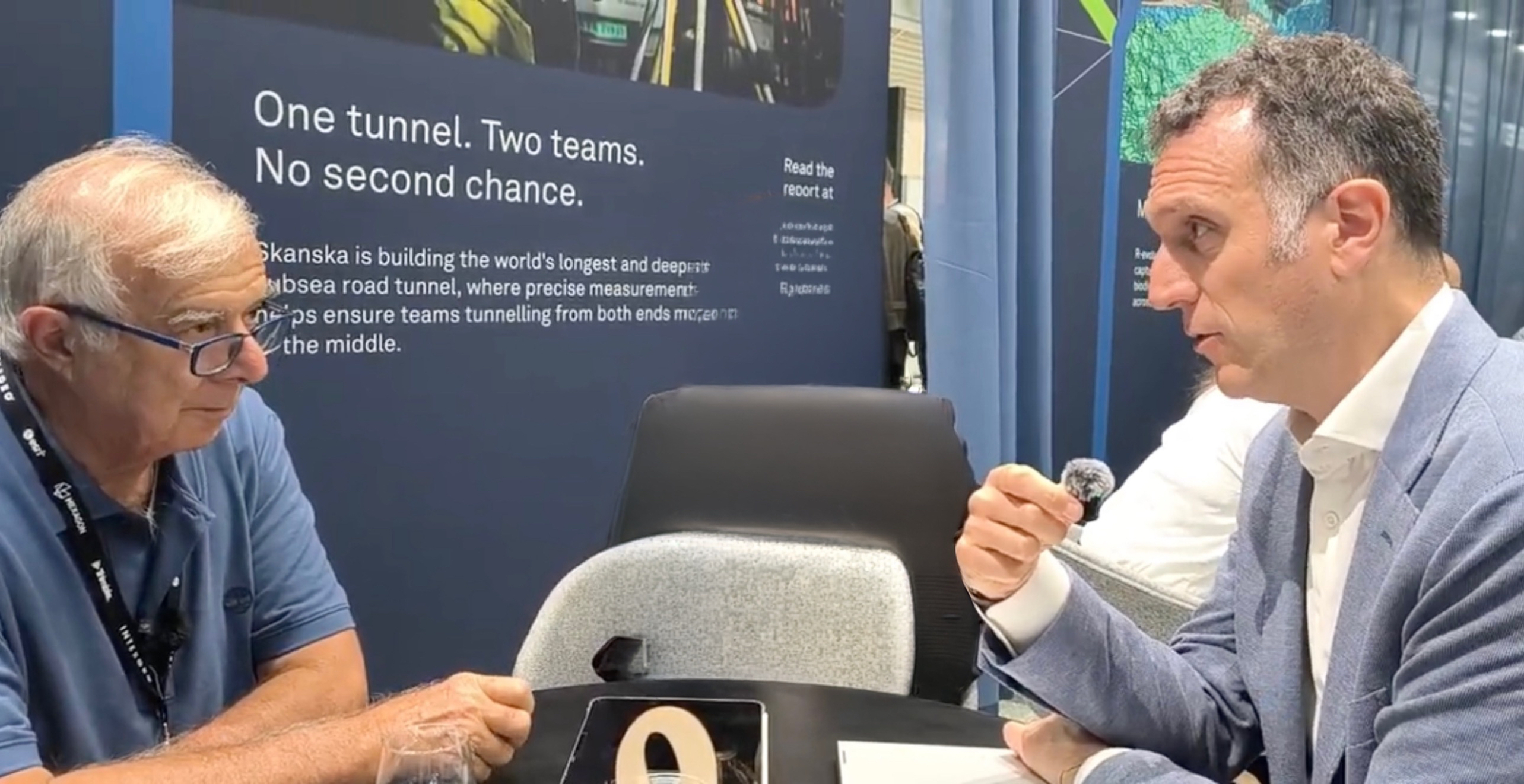
GEOmedia discussed these questions with Andrea Biasion, Director TLS program and Luana Febi, Market Development Manager TLS, at Leica Geosystems..
Renzo Carlucci, GEOmedia: I am Renzo Carlucci, Chief Editor of GEOmedia Magazine. We are here today to hear about the latest developments from Leica Geosystems. Andrea, could you introduce yourself?
Andrea Biasion: Nice to meet you, Renzo. My name is Andrea Biasion. At Leica Geosystems, I lead the TLS program, which covers the RTC family and the BLK360—our main lineup of static laser scanners.
Luana Febi: Hi everyone, I'm Luana Febi. I work alongside Andrea on the Reality Capture team, focusing on the RTC Series. One of my key focus areas is turning market analysis and user feedback directly into actionable product strategy.
GEOmedia: Let us start with the first question. Are TLS, mobile mapping and mobile laser scanning still separate technologies, or are they becoming part of a single Reality Capture workflow?
Andrea Biasion: When it comes to technology, there are definitely synergies between the different product lines, particularly in terms of the scalability of technologies across different products. When we look at product usage, applications, reference markets and customers, however, the boundaries between TLS, mobile mapping and mobile scanning are becoming increasingly thin. There is definitely a convergence taking place. I think that, in the future, the key for companies and other players in the market—but even more importantly for our customers—will be the integration of whichever tool works best for a particular application, job or project, without necessarily making a rigid distinction between those three different product lines.
GEOmedia: As Reality Capture becomes faster and more automated, where is survey-grade accuracy still essential? mobile laser scanning technology, for example, is now extremely fast. You can move rapidly through a building and obtain a survey. But is survey-grade accuracy still essential?
Andrea Biasion: It is. It remains essential in many applications—probably many more than one might initially think when looking at Reality Capture as a discipline. From Leica's perspective, we would like to reduce the extent to which customers have to choose between speed and accuracy. In the Reality Capture industry there has traditionally been a trade-off between the two. If you are fast, you lose accuracy; if you are accurate, you lose speed. Because of Leica's DNA and history, we come from the accuracy side of that trade-off. Our challenge for the coming years is therefore to serve customers with solutions that maintain our heritage and historical legacy in areas such as accuracy, while at the same time increasing productivity. That is exactly what we have done with the new RTC scanners: pushing efficiency, speed and productivity to the next level for our customers, but without compromising accuracy.
GEOmedia: Luana, I have a very simple question for you. Let us talk about the voice of the customer. You are listening to many customers, so what would you suggest to young people and young professionals who want to start working in this field? Where should they direct their attention in the future?
Luana Febi: One important thing to consider is that nowadays Reality Capture is no longer just for surveyors. There are many different players in the market, and Leica Geosystems itself has contributed to what we call the democratization of Reality Capture: making it possible to use this technology much more widely.
GEOmedia: And by everybody?
Luana Febi: Yes, exactly. The objective is to enable many more people to use the technology. Ten years ago, that would have been very difficult. Scanners were large and slow, and the technology was very complex to use. Today, we have built solutions that can reach many more users and many different market segments. I would also say that TLS can be one of the easiest technologies to use. With mobile laser scanning and mobile mapping, you can achieve a very high level of productivity, but you still need to rely on a skilled technician—a professional who really understands what he or she is doing. With TLS, we can put the instrument, the ecosystem and the solution into the hands of a much wider group of users. With Leica products in particular, different types of operators can work in the field while receiving supervision and coordination from the office. With the new products, we have what we call a collaborative workflow, and this is a very important aspect of the new RTC Series because we can connect the field and the office in real time. This means we can check what is being done in the field while, at the same time, starting to work with the point cloud and producing deliverables while the field crew is still acquiring data.
MLS is known for speed, but TLS drives high overall productivity by combining user-friendly capture with automated office workflows. Because TLS produces exceptionally clean and precise point clouds, the data is primed for AI classification, efficient filtering, and streamlined processing.
Andrea Biasion:
I’d like to return to the question about the future of geomatics and geodesy. Democratizing Reality Capture is making digital workflows accessible across countless new industries—far beyond what anyone imagined a decade ago. That said, specialized expertise still matters. A strong foundation in geomatics and geodesy remains a true competitive advantage, especially for complex projects where deep surveying knowledge makes all the difference.
However, driving widespread digital transformation across industries requires lowering the barrier to entry. To unlock efficiency and automation, we must reduce tool complexity.
GEOmedia: This is very important.
Luana Febi: I would add something regarding skilled surveyors and power users. It is true that our technology is strongly connected with democratization, as I mentioned before. But there is another question we should consider: is the surveyor's job only about surveying and capturing data, or is it also about handling and managing that data in order to produce deliverables, knowledge and insight? Our goal is to make data capture easier, faster and more productive so that surveyors and skilled operators can invest more of their time in finding insight and knowledge in the data and helping their customers create value from it. The objective should not be simply to spend professional time capturing data in the field. An important part of the work takes place in the office, in front of the captured data, where professionals can use their expertise to extract knowledge and create value for their customers.
GEOmedia: I think this is a good point on which to conclude. Thank you very much for sharing Leica Geosystems' perspective and knowledge in this field.
Andrea Biasion and Luana Febi: Thank you, Renzo.
“Our goal is to make capturing the data easier and faster [...] to let surveyors and skilled operators invest their time in finding insight and knowledge from the data.”
From capturing reality to extracting knowledge
The discussion with Leica Geosystems highlights two developments that may initially appear contradictory. On one side, Reality Capture is becoming easier, faster and more accessible. The traditional boundaries between terrestrial laser scanning, mobile mapping and mobile laser scanning are becoming less rigid. Collaborative workflows increasingly connect field and office, while automation and AI can accelerate operations that once required substantial manual intervention.
On the other side, accuracy and specialist knowledge are not disappearing.
The convergence of technologies means that the question is increasingly not which category of instrument should be used, but which combination of tools best serves the requirements of a particular project. Speed matters, but so does the reliability of the resulting spatial information. The approach described by Andrea Biasion is therefore not to abandon survey-grade accuracy in favour of productivity, but to reduce the traditional trade-off between the two. The democratization of Reality Capture also has an important consequence for the surveying profession. If more operators can acquire data using increasingly accessible instruments, the professional role of the surveyor does not necessarily become less relevant. Instead, its centre of gravity can move further along the value chain. Professional expertise increasingly lies beyond simply operating a scanner. It includes understanding geometry, assessing data quality, selecting the appropriate acquisition method, managing point clouds and determining how raw measurements can be transformed into reliable information.
This is also where collaborative workflows, automation and artificial intelligence become particularly relevant. A clean, accurate and high-quality point cloud provides a strong foundation for automated classification, cleaning and subsequent information extraction. Automation can remove repetitive operations while leaving skilled professionals more time for interpretation and higher-value analysis. The relationship between field and office is also changing. If data can be checked, processed and transformed into deliverables while acquisition is still taking place, the traditional sequence of fieldwork followed by back-office processing becomes increasingly integrated.
The evolution described by Leica Geosystems can therefore be understood as a progression:
Capture → Validate → Collaborate → Automate → Understand → Create value
In this progression, making Reality Capture easier does not remove the need for surveying expertise. Instead, it can free professionals from part of the acquisition burden and allow them to concentrate on where their knowledge creates the greatest value.
As capturing reality becomes easier, professional value increasingly comes from understanding what the data means and knowing how to turn it into knowledge.
Explore all interviews & insights from Munich
Follow GEOmedia’s post-INTERGEO coverage across Reality Capture, GNSS & Positioning, GeoAI and Digital Twins.
EXPLORE THE COMPLETE SERIES →INTERGEO 2026 · Reality Capture & Surveying
Leica Geosystems
TLS · RTC Series · BLK360 · Mobile Mapping · mobile laser scanning · Survey-Grade Accuracy · Collaborative Workflows · AI · Geomatics



