

The geospatial industry has become exceptionally good at capturing the physical world. The next challenge is to understand that growing volume of information, keep it connected to reality as conditions change and use it to support decisions and actions.
For generations of surveyors, the principal task has been to observe, measure and accurately record the physical world. Today, however, the enormous quantity of geospatial information being captured creates a different challenge: how can we understand all that data and use it to drive decisions and actions? Artificial intelligence is beginning to change this relationship. Machine learning can already help classify billions of points and extract meaningful objects from point clouds. The next step, according to Trimble, could be the use of AI agents not simply to provide insights, but to help initiate actions based on those insights.
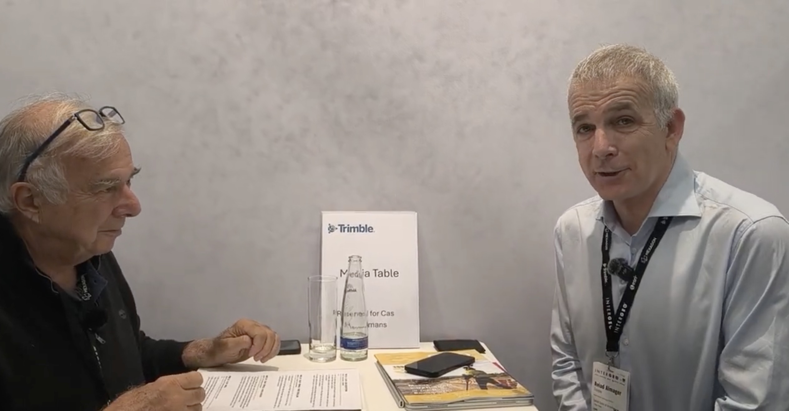
GEOmedia discussed this evolution with Aviad Almagor, who leads Trimble’s Office of Technology Innovation.
Renzo Carlucci, GEOmedia: I am Renzo Carlucci, Editor-in-Chief of GEOmedia magazine. Today we are with Trimble and Aviad Almagor. Could you introduce yourself?
Aviad Almagor, Trimble: Certainly. I am Aviad Almagor, and I manage the Office of Technology Innovation at Trimble. I joined Trimble approximately 14 years ago, and I am an architect by profession. At Trimble, I focus on emerging technologies, artificial intelligence and the impact that these technologies are having on our industry and, of course, on our commercial offerings.
GEOmedia: Trimble has been an important reference point for Italian surveyors for many years. I remember the company from the early development of GNSS systems. Looking towards the future, what would you suggest to the new generation of surveyors? Where should young professionals direct their knowledge and experience?
Aviad Almagor: I think this is an exciting moment to join the surveying community because the industry is changing dramatically. The importance of geospatial data is becoming increasingly critical, particularly in the age of AI and, even more specifically, with the development of agentic AI processes, where we want artificial intelligence to be able to take action. I see the industry transitioning from one that primarily captures and records data towards one that can reason about that data and drive actions from it. That is a major transformation, and it puts geospatial information at the centre of many of the changes taking place today, including those in the architecture, engineering and construction environment.
GEOmedia: You mentioned artificial intelligence. Are you already using AI directly within Trimble software?
Aviad Almagor: Certainly. AI is already being used across many of our products, starting with classical AI and machine-learning processes. As surveyors, we face an interesting challenge: we capture enormous quantities of data, but we do not necessarily have the capacity to manually process all of it and understand what all that information means. AI fits precisely into this space. It can take those huge quantities of data, process them and provide insights. That is the first stage, and it is already happening within our software solutions. Imagine, for example, capturing a point cloud containing billions of points in space. We can apply AI to begin identifying and classifying those points, recognizing features and extracting objects. AI can identify, for example: this is a column, this is a wall, this is a kerb in the road. Artificial intelligence can certainly help with these processes.
Aviad Almagor: The next phase, which we are also beginning to see, is how we can use AI agents to drive actions. It is no longer simply about providing an insight to the user. It is also about helping the user translate that insight into an action in the field.
GEOmedia: So we are moving from using AI to understand geospatial data towards using that understanding to influence the next stage of the workflow?
Aviad Almagor: Exactly.
GEOmedia: We are talking about enormous quantities of data, and today we also have cloud technologies that can help us manage them. But who should maintain this information over time? Should it be the surveyor or the final customer? Traditionally, a surveyor completes the work, stores the results on a hard drive and delivers them to the customer. Cloud-based workflows could change this model. Does Trimble see a particular direction here?
Aviad Almagor: That is a fantastic question. I think the separation you have described—the siloed process—is one of the challenges the industry is facing. There may be practical reasons why these separations exist today, but our vision is to bridge this gap and create a continuous data stream between the field and the office. It is about connecting the office with the field and connecting the digital world with the physical world in order to support decisions. This is particularly important because once you capture the world, it is already changing. If you do not maintain and update that information, you eventually find yourself making decisions based on a representation of a world that no longer exists. And that creates risk.
GEOmedia: Looking beyond traditional surveying, which markets and professional communities is Trimble focusing on today? Where do you see the expansion of geospatial technology taking place?
Aviad Almagor: There are several aspects to this. Trimble as a company serves the surveying and broader geospatial market, as well as architecture, engineering and construction, asset management, and the transportation and logistics markets. There are obviously many subsectors within these areas, but those are some of the major markets we serve. What I think is particularly interesting for geospatial professionals—and surveyors specifically—is that we are seeing a convergence between workflows. In the past, certain workflows were almost exclusively the responsibility of surveyors. Today, we see those processes increasingly extending into architecture, engineering, construction and operations. AI can support this evolution. Automated processes can extend the reach of surveying information further downstream, into actual construction processes and eventually into operations and asset management.
GEOmedia: Thank you very much.
“I see the industry transitioning from one that primarily captures and records data to one that can reason about that data and drive actions from it.”
From capturing reality to acting on it
The Trimble interview highlights a shift that goes beyond the adoption of artificial intelligence as another processing technology. The geospatial industry can already capture extraordinary quantities of information. Reality Capture systems, surveying instruments and sensors can generate point clouds containing billions of measurements. The limitation is increasingly not acquisition itself. It is the ability to understand what those measurements represent and connect that understanding to operational decisions.
Artificial intelligence plays a natural role in this transition.
A human operator cannot manually inspect billions of individual points. Machine-learning processes can begin converting that raw geometry into structured information by identifying recurring objects and features. The progression becomes:
Point → Classification → Object → Meaning
A collection of points becomes identifiable as a wall. Another group becomes a column. Another becomes a road kerb. Once geometry has been transformed into objects and meaning, the next question is what happens with that information. This is where Almagor introduces the concept of agentic AI. Instead of artificial intelligence stopping at the production of an insight, AI-enabled workflows could increasingly assist with subsequent actions based on that insight.
The progression can therefore extend further:
Capture → Classify → Understand → Decide → Act
At the same time, the interview raises another fundamental issue: time. A traditional survey represents the physical world at a specific moment. A point cloud, map or model is therefore effectively a snapshot. But construction sites change. Infrastructure changes. Buildings are modified. Assets are installed, moved, maintained and replaced. As Almagor notes, once you capture the world, it is already changing. If geospatial information is used in construction, Digital Twins, asset management or operational decision-making, its value therefore depends not only on the accuracy of the original capture but on the ability to keep that digital representation aligned with physical reality. This changes the traditional surveying sequence.
Instead of:
Capture → Process → Deliver → Archive
the workflow can evolve towards:
Capture → Process → Understand → Update → Decide → Act → Capture Again
Geospatial information becomes less of a final product and more of a continuously evolving component of operational processes. This also changes the question of responsibility. The issue is not necessarily whether the surveyor or the client alone should maintain the data. The more important challenge is how surveyors, designers, contractors, asset managers and digital platforms can contribute to a continuous information flow between the physical and digital worlds. For the surveying profession, this creates an opportunity. Surveying expertise remains fundamental because every digital workflow ultimately depends on a reliable spatial relationship with physical reality. But that expertise can increasingly extend beyond initial acquisition into construction, operations, Digital Twins and asset management. The surveyor can therefore contribute not only to capturing reality, but also to establishing and maintaining the trusted geospatial foundation on which AI-driven processes operate.
The broader evolution described by Trimble can be summarized as:
Capture → Classify → Understand → Maintain → Decide → Act
The future of geospatial technology is not simply about producing a digital representation of the world. It is about keeping that representation connected to a changing physical reality—and using it intelligently to determine what happens next.
Explore all interviews & insights from Munich
Follow GEOmedia’s post-INTERGEO coverage across Reality Capture, GNSS & Positioning, GeoAI and Digital Twins.
EXPLORE THE COMPLETE SERIES →INTERGEO 2026 · GeoAI & Connected Workflows
Trimble
Artificial Intelligence · Agentic AI · Point Clouds · Machine Learning · Continuous Data · Reality Capture · Digital Twins · Construction · Asset Management · Geospatial Workflows



