

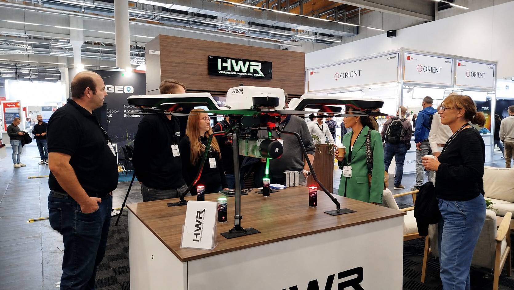
High-precision positioning is moving far beyond the traditional surveying market. Robotics, autonomous systems, UAVs, machine control and connected geospatial platforms are creating new requirements for GNSS — and INTERGEO 2026 in Munich will provide an important window into this transformation.
For decades, high-precision GNSS has been one of the foundations of professional surveying. That role is not disappearing. What is changing is the range of applications that now require centimetre-level positioning.
Autonomous machines need to know not only where they are, but also their orientation and trajectory. UAVs require precise positioning for mapping and inspection. Agricultural equipment, robots and mobile mapping platforms increasingly depend on positioning that can operate continuously and integrate with other sensors.
As a result, GNSS is becoming less of a standalone surveying technology and more of a component of a broader Positioning, Navigation and Timing (PNT) ecosystem.
From the survey pole to autonomous systems
Traditional geodetic GNSS receivers have evolved around demanding professional requirements: accuracy, reliability, correction services and efficient field workflows. Those requirements remain important, but a new market is developing alongside them. High-precision positioning is increasingly being embedded directly into machines and platforms.
Robotics, precision agriculture, autonomous vehicles, UAVs and industrial systems need positioning technology that is smaller, easier to integrate and capable of operating at scale.
This changes the architecture of GNSS solutions. Instead of positioning being provided exclusively by a dedicated field instrument, high-precision GNSS can become an embedded component inside a much larger system.
Centimetres at scale
One of the most significant developments is therefore the expansion of centimetre-level positioning beyond specialist geodetic equipment. Multi-frequency and multi-constellation receivers can access a growing number of satellite signals, while RTK, PPP-RTK and PPP correction approaches provide different ways of achieving high accuracy depending on the application.
At INTERGEO 2026, this evolution will be visible in new generations of positioning technology.
Among the examples already announced for Munich, u-blox will showcase its X20 high-precision GNSS platform, including the ZED-X20P all-band positioning module and the dual-antenna ZED-X20D.
Their significance goes beyond individual products. They illustrate a broader transition towards compact GNSS technologies designed to bring centimetre-level positioning into robotics, agriculture, autonomous systems and other high-volume applications.
Position is no longer enough
Knowing coordinates is only part of the problem for an autonomous or mobile platform. A robot, vehicle or mapping system also needs to understand its heading, movement and relationship with its surroundings. This is driving closer integration between GNSS and other technologies such as inertial measurement units, cameras and LiDAR. Sensor fusion becomes particularly important when satellite signals are obstructed or degraded. Urban environments, vegetation, tunnels, industrial facilities and indoor-outdoor transitions all demonstrate the limitations of relying on a single positioning technology.
The future of positioning is therefore likely to be increasingly multi-sensor.
GNSS provides a global reference. Inertial sensors maintain information about movement. Cameras and LiDAR can help a system understand its local environment. Algorithms combine these observations into a continuous navigation solution.
From GNSS to PNT
This evolution also explains why the industry increasingly talks about PNT rather than GNSS alone. Positioning, Navigation and Timing describes a capability rather than a particular sensor. GNSS remains fundamental because it provides a global, standardized reference. But demanding applications increasingly require systems capable of maintaining that capability when operating conditions change.
Reliability, integrity, interference awareness, security and resilience consequently become as important as nominal accuracy.
This is particularly relevant as precise positioning moves into applications where the output is used directly by machines rather than interpreted by a professional surveyor.
Corrections become part of the infrastructure
The positioning ecosystem is also changing at the service level.
RTK networks have long been familiar to surveyors. Today, correction services are expanding towards scalable delivery models designed for devices and fleets operating across large geographical areas.
This could have significant consequences for the geospatial industry. Positioning may increasingly be consumed as a continuously available service rather than configured independently for every project.
For manufacturers and software developers, this creates opportunities to integrate high-precision location directly into applications.
For users, it could progressively reduce the technical boundary between professional geodetic positioning and other location-aware systems.
A convergence visible at INTERGEO
INTERGEO itself reflects this transformation, the 2026 event brings together surveying and GIS with Earth observation, BIM, digital twins, unmanned systems, robotics and autonomous technologies.
GNSS is therefore no longer confined to one corner of the geospatial market, it increasingly provides the spatial reference connecting many of these technologies.
The INTERGEO 2026 programme reinforces this perspective, with GNSS appearing on the MAIN Stage and the Conference addressing both the future of GNSS and navigation and mobile surveying.
For GEOmedia, the question to investigate in Munich will therefore not simply be “What is new in GNSS receivers?”
A more interesting question is:
What happens when high-precision positioning becomes an embedded infrastructure for machines, sensors and autonomous systems?
That transformation could significantly expand both the applications and the market for geospatial positioning technologies.
GEOmedia Road to INTERGEO 2026
GEOmedia will be at INTERGEO 2026 in Munich, 15–17 September, following the technologies and international companies shaping the next generation of the geospatial industry.
This article is part of GEOmedia's Road to INTERGEO 2026. Follow our international coverage, get your free visitor ticket and meet GEOmedia in Munich.
EXPLORE GEOmedia AT INTERGEO 2026 →


