

Certified and Unalterable Evidence of Timestamp and Precise Location through Galileo GNSS, even for Drone Flights Certification.
Digital Data to be Verified? A Growing Necessity
In our job, the need to guarantee the authenticity, provenance and traceability of: data, images, and documents is continuously growing. Not only surveys, but business and administrative tasks rely on uncertified dates and location statements, taking risks as:
- Falsification of location and timestamp
- Loss of digital traceability
- Difficulties with verification for administrative processes
ATLHAS technology, (patent already registered), allows to certify the authenticity of both position and timestamp (date and time) of any multimedia file, through the integration of Galileo Constellation GNSS data.
Traditional Timestamping Systems are based on centralized servers or blockchain, but do not guarantee independent verification of the position. ATLHAS fills this gap ensuring that position and time are not and cannot be altered.
Results: a proof of inalterability and authenticity of photos, images, videos without the possibility of subsequent alteration, offering the probative value of the content (position, time, direction and field of view) for any surveys, flights and for insurance, legal affairs, commercial vehicles, etc.
How it Works
- Data capture - a file (image, video, audio, document) is captured and associated with certified GNSS data.
- Position verification - location signals are verified to ensure they are from authenticated satellites (Galileo) and have not been manipulated.
- Certification - a cryptographic hash of file is associated with the authenticated location/time data and then recorded to blockchain for immutable proof.
- Fake photo detection - By combining “visual forensics” with certified GNSS metadata (position, time, direction, and field of view), ATLHAS enables the detection of manipulated images (e.g., photos taken of other photos or out-of-context captures), providing strong evidence against media falsification or misuse.
- Integrity check - At any later time, the certified file can be verified against the original GNSS timestamp and location data to confirm its integrity and authenticity, ensuring it has not been altered since the moment of capture.
The certification is done via ATLHAS dedicated receivers + App or SDK with seamless integration into client applications.
Preventing Deep Fake Positioning
To combat the growing risk of Deep Fake Positioning, ATLHAS platform integrates robust anti-spoofing services. These services are designed to detect and flag any attempts to manipulate or fake the reported geographical coordinates and timestamps (even fake photos). By continuously analyzing data for inconsistencies and signs of digital tampering, ATLHAS ensures integrity and authenticity of all location and time-based evidence. This proactive approach provides security and trust for all our territorial data treatment.
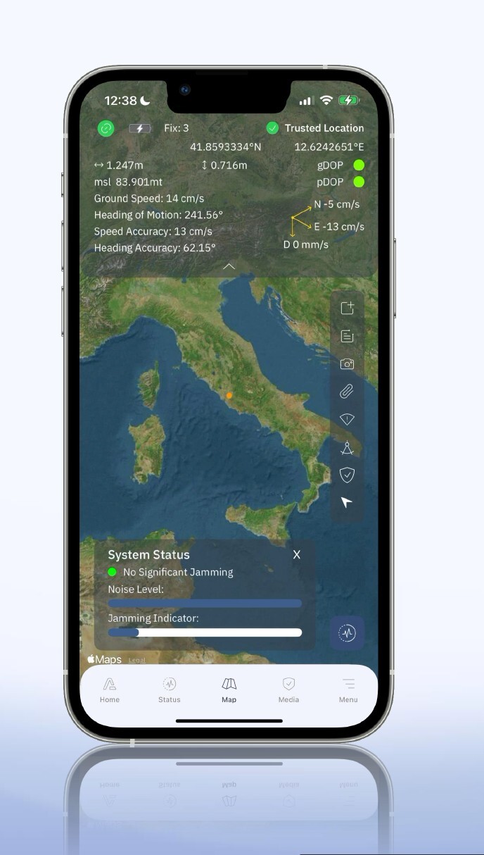
Key Features
- Qualified Position and Timestamp Authentication: Galileo OS-NMA + ATLHAS GEO-TAG Verification provide unalterable authentication.
- Media Validation: Guarantee of content integrity.
- Account Identification: Precise verification of device and account
- Data Security: Multi shield encryption and secure cryptographic protocols
- Higher Precision GNSS: Multi-frequency GNSS with SBAS and RTK correction
- SDK and Integrations: App or SDK with seamless integration into client applications
Unmatched High Precision
ATLHAS also delivers centimeter-level precision through advanced multi-frequency GNSS positioning with SBAS and RTK correction technologies.
ATLHAS combines multiple satellite constellations and real-time corrections to achieve positioning accuracy that exceeds industry standards (costs comparison), ensuring every authenticated location meet the most demanding professional requirements for verification and compliance.
- UP TO 20 CM With SBAS
- UP TO 2 CM With RTK
Use Cases
ATLHAS is designed to be used both by Space Data Experts and Private Citizens, Meeting needs of every user expertise level.
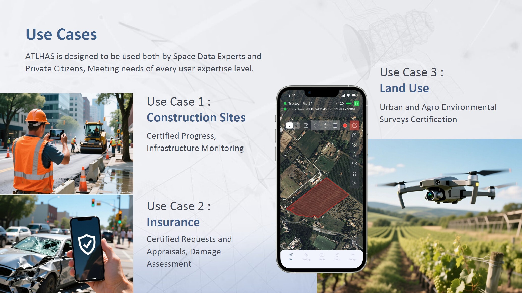
- Use Case 1 - Construction Sites: Certified Progress, Infrastructure Monitoring
- Use Case 2 - Insurance: Certified Requests and Appraisals, Damage Assessment
- Use Case 3 - Land Use: Urban and Agro Environmental Surveys Certification
Drone and Aerial Flight Certification
ATLHAS technology allows precise perimeter mapping and detailed tracking for both drone and aerial surveys. ATLHAS embeds unalterable evidence of location and timestamp within the recorded multimedia files (photos, videos). E.g. certified forest fire perimeters can replace the ground manual surveys of Forest Guards for the necessary legal consequences (Law 353/2000.
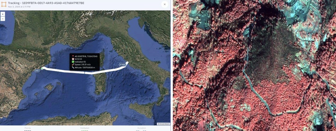
This guarantees the unequivocal authentication of a drone's flight path, an aerial inspection, or the secure traceability of any defined movement, such as the log of a commercial flight. The resulting authentication grants the content (position, time, direction) undeniable proof, crucial for regulatory compliance, legal affairs, and insurance purposes.
CAP (Common Agricultural Policies) Processes, Farmers & Paying Agencies

- Enables farmers to certify the information from their “Aid Applications”
- Avoids expensive and often late coming ground checks, replacing any non-possible Sentinel detection
- Enables Paying Agencies to automate and validate their review, preserving their resources and EU/national funds
- Enables earlier & safer validations and payments to the farmers
Application Segments
- Drone Flight certification
- Car/Trucks Movement certification
- Traceability for any Insurance need
- Traceability in the Food Sector
- Traceability in the Legal/Notarial field
- Traceability in Anti-fraud Systems
- Traceability in the Agri-environmental Sector
Real World Impact
- ATLHAS enables authenticated, faster and more efficient workflows
- ATLHAS can replace on-site inspections through automated verifications
- ATLHAS ensures and certifies the operational truth when using, processing, and transmitting digital data



