

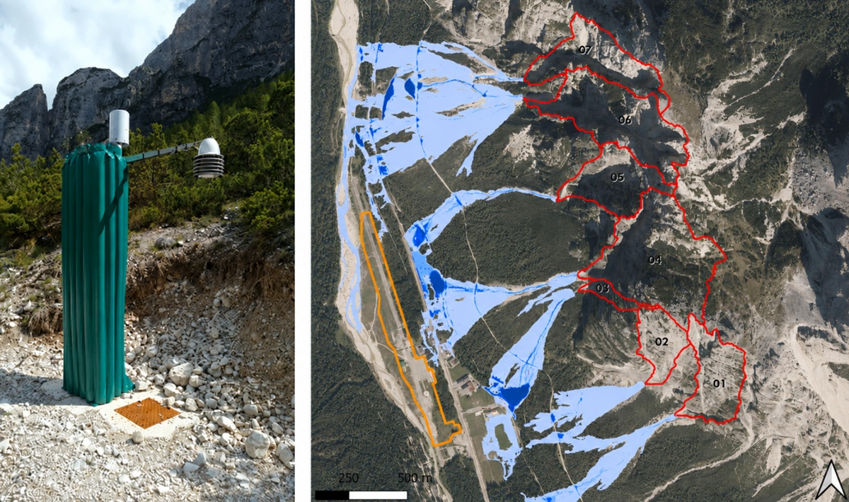
In mountainous environments, extreme rainfall events can rapidly evolve into destructive debris flows, threatening roads, infrastructure, and communities within minutes. To address this challenge, activities within the IRIDE / CyberItaly framework demonstrate how Earth Observation, numerical weather prediction, and in-situ monitoring can be combined into an integrated Digital Twin for near-real-time hazard anticipation in alpine environments.
The Digital Twin system has been developed by DAO (Autorità di Bacino Distrettuale delle Alpi Orientali), and integrated into the CyberItaly platform developped by Serco Italia, as a support tool contributing hazard scenarios, hydrological-hydraulic expertise, and basin-scale debris-flow modelling capabilities for hazard assessment and monitoring.
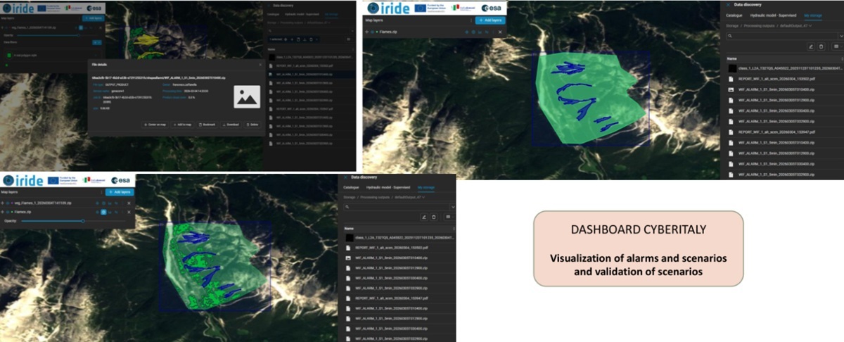 Figure 2 – Operational dashboard for alarm and what-if scenario visualization.
A Digital Twin for debris-flow forecasting
The Digital Twin architecture integrates numerical weather prediction forecasts, real-time telemetry from in-situ weather stations, satellite imagery, digital elevation data, and debris-flow propagation scenarios derived from the hydraulic modelling of the Flood Risk Management Plans.
The workflow includes:
- ingestion of weather forecasts and in-situ telemetry data
- threshold exceedance analysis
- statistical matching against predefined debris-flow scenarios
- generation of impact layers and awareness reports
- simulation of alternative “what-if” meteorological scenarios
Custom thresholds trigger alerts, while routine reports are produced daily to support decision-makers in risk management activities.
Earth Observation contribution
IRIDE and Copernicus imagery support the monitoring of vegetation and surface conditions, as well as the validation of debris-flow scenarios through NDVI-based analyses. The processing chain is designed to seamlessly integrate multi-source EO datasets, strengthening both monitoring and model validation capabilities.
Scalability and resilience
The methodology has already been successfully tested in the Fiames area (Cortina d’Ampezzo, Belluno Province, Italy) and across additional alpine basins and hydrographic districts, demonstrating the reliability, portability and robustness of the processing chain in heterogeneous geomorphological contexts.
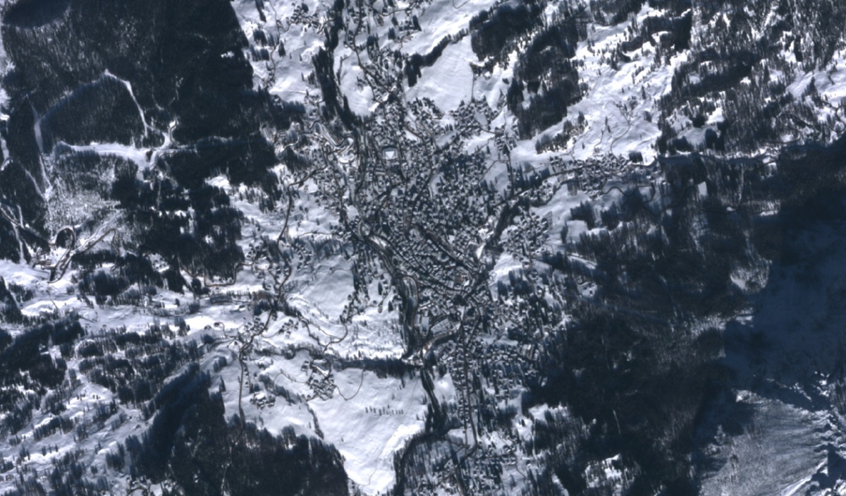 Figure 3 – IRIDE (HEO) imagery over Cortina D’Ampezzo taken during the Olympic Games.
Future developments
Future activities will focus on predictive uncertainty estimation, climate-change-informed rainfall anomalies, dynamic modelling, and broader integration of IRIDE data products for continuous monitoring of sediment availability and mountain-territory resilience and improvement of vegetation indexes with high resolution satellite images.
IRIDE: enabling a new generation of services
This activity has been perfomed in the context of IRIDE Project, Italy’s ambitious Earth Observation constellation whose development is managed by ESA with the support of ASI and national institutions. IRIDE is designed to deliver high-frequency, high-resolution data across multiple spectral domains, enabling a new class of operational services for environmental monitoring, risk management, and urban governance.
Within the IRIDE framework, the Debris-Flow Digital Twin demonstrates how integrated EO-based services support hydrogeological risk management in complex alpine environments. Developed by DAO and hosted on the CyberItaly platform by Serco Italia, it combines IRIDE and Copernicus data, numerical meteorological prediction, in-situ measurements, and debris-flow models into a unified workflow. The system enables near-real-time alerts, what-if simulations, and multi-source data integration, contributing to the de-risking of future Digital Twin services and supporting scalable resilience solutions.
Sources:
Technical material source: EO-PNRR-IRIDE-Project – IRIDE CYBER ITALY DIGITAL TWIN – Debris Flow Prediction.
DAO – Autorità di Bacino Distrettuale delle Alpi Orientali



